NIKE Anti-Aircraft Missile Complex
Launch site (secure area - GPS withheld)
Radar site (occupied area - GPS withheld)
 NIKE missile launch site. Three missile bays are located here. |
 The black and yellow striped doors are open and the hydraulic missile elevator is in the raised position. |
 Part of the missile bay. Each bay stored 12 missiles. |
 A missile maintenance shed at the entrance to the launch site. |
 Located in this photo are two former NIKE missile radar towers. The radar domes have been removed. There were a total of 5 radars here. |
 The launch area. |
Miscellaneous

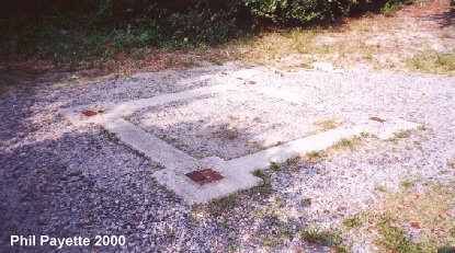
Tower A foundation next to the Meteorological Station (N 36Ḟ54.982 W076Ḟ00.187).
Part of the Tower B foundation is nearby (N 36Ḟ54.967 W076Ḟ00.183).
These were steel observation & signal towers located on "Boy Scout Hill."
Also nearby is the radio room (N 36Ḟ55.343 W076Ḟ00.264)

A former gate to the Army base. (N 36Ḟ55.206 W076Ḟ01.261)
Route 60 (Shore Drive) is in the background.
 Stairway foundation to Granite Tower B (N 36Ḟ55.350 W076Ḟ02.531 USCGS). No other trace remains. A switchboard room is to the rear. The Tower C site (N 36Ḟ55.515 W076Ḟ02.599 USCGS) is in the parking lot. |
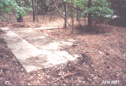 Foundation to Granite Tower A (N 36Ḟ55.455 W076Ḟ02.502 USCGS). A Map Control Station (N 36Ḟ55.455 W076Ḟ02.493 USACE) was located to the rear and is marked by a Corps of Engineers benchmark. |
 East End Tower foundation (N 36Ḟ54.779 W075Ḟ59.944 USCGS). Foundations to the Seacoast Radar tower (N 36Ḟ54.823 W075Ḟ59.984) and supporting structures were found nearby. |
 A Terminal Hut (N 36Ḟ54.920 W076Ḟ00.085) for the East End Station. |
 Auxiliary Command Post (N 36Ḟ54.891 W76Ḟ00.070) for the East End Station. |
 Auxiliary Command Post (N 36Ḟ55.260 W076Ḟ00.536 USCGS "Ft Story") for the West End Station. |
NOTE: The West End Tower foundation (N 36Ḟ55.343 W076Ḟ00.694 USCGS)
is in a heavily overgrown area.
Although it can be found, photographs are not possible.
The West End Terminal Hut no longer exists.

One of three World War II era magazines. (N 36Ḟ55.573 W076Ḟ01.376)

 |
|
 |
|
