Sisters' Point Base-End / Radar Station - Location 149
B9/2 S9/2 and B5/1 S5/1 Fort Dearborn - B4/6 S4/6 Fort Foster

This five-story concrete tower was completed in July 1942 on a government-owned 4.71 acre site as a combined Base-End Station for Fort Foster and Fort Dearborn. The Army barracks was not attached to the tower. The fifth-story observation level was intended for Battery 205 (B4 S4), the fourth-story level was for Battery 204 (B5 S5), and the third-story level was for Battery 103/Seaman (B9 S9). The fifth level was later changed to the HD OPS 3 station for the Portsmouth Harbor Defense Operations Command. The roof deck/balcony was used for the anti-aircraft intelligence service (AAIS OP 8). Searchlight positions #13 and #14 were located southwest and southeast of the tower. An SCR-296A fire-control radar on a 100-foot tall steel-frame tower, with an adjoining concrete-block operating room, was located on the north-side of the concrete tower. An SCR-268 mobile radar unit was set up in 1944 southeast of the concrete tower, adjacent to searchlight #14. The concrete tower, located at the end of Goodwin Road, was demolished by the new landowners in May 2004. There are no visible remains today.
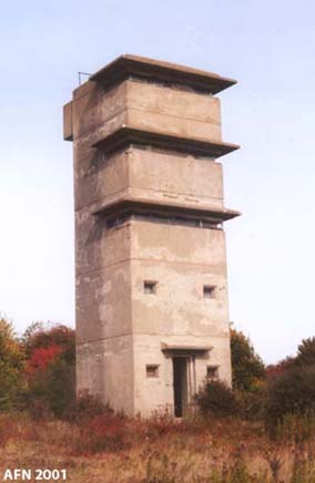
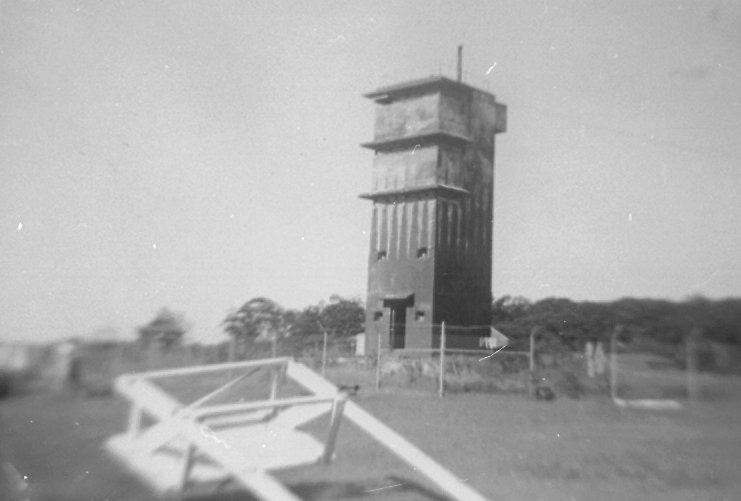
circa 1944 photo
GPS for Base-End Station (OC2197) - N 43° 04.534 W 070° 40.078 (NAD 83)
GPS for Location 149 Benchmark (OC0496) - N 43° 04.538 W 070° 40.083 (NAD 83)
Located at Sisters' Point, Gerrish Island, Kittery, Maine.
Private Property!
courtesy of NOAA - Coast & Geodetic Survey Historic Image Collection
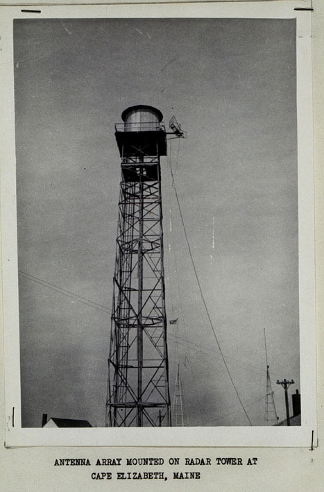
A typical SCR-296A radar tower, located at Cape Elizabeth, Maine, 1946.Shown is a post-war NOAA SHORAN antenna array attached to the SCR-296A radar tower frame.
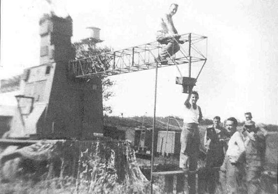
photo by Don MacKenzie, courtesy of Gerald Butler
An SCR-268 mobile radar unit set up at Sisters' Point in 1944.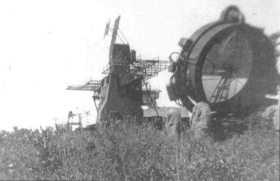
photo by Don MacKenzie, courtesy of Gerald Butler
Another view of the same SCR-268 radar, with a 60-inch searchlight.

WWII TOWERS HOME